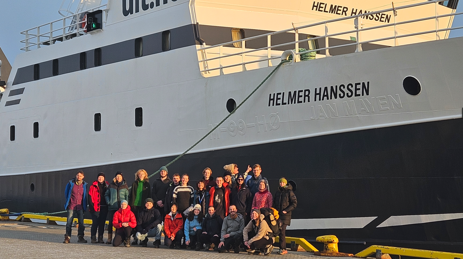
The next generation of Arctic experts mapping seafloor with QPS software University Centre in Svalbard
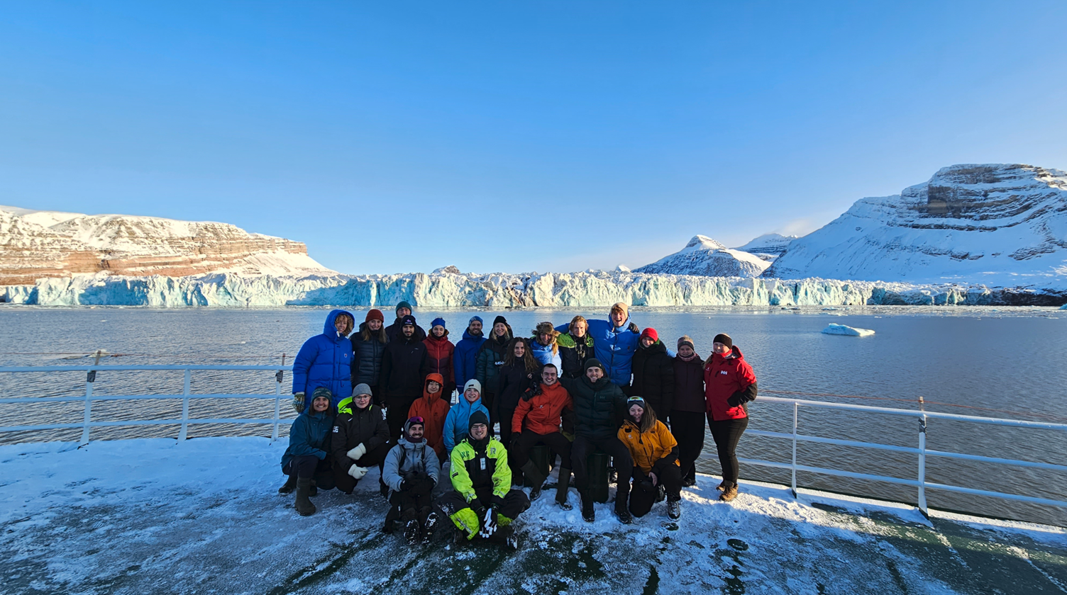
Mapping the uncharted seafloor in the Arctic is a challenging task. Unknown rocks and shallows, sea ice and icebergs and frequent storms, not to mention the several months-long darkness of the polar night. UNIS’ educational focus on training practical Arctic field work skills ensures that students learn to tackle these challenges from the day one. 2023 class of Arctic marine geology students set off to study the seabed of NW Svalbard, from Norskebanken through Raudfjorden to Kongsfjorden. During the five days long cruise on a R/V Helmer Hanssen, the students studied the structure and properties of water column, seafloor as well as subbottom sediments.
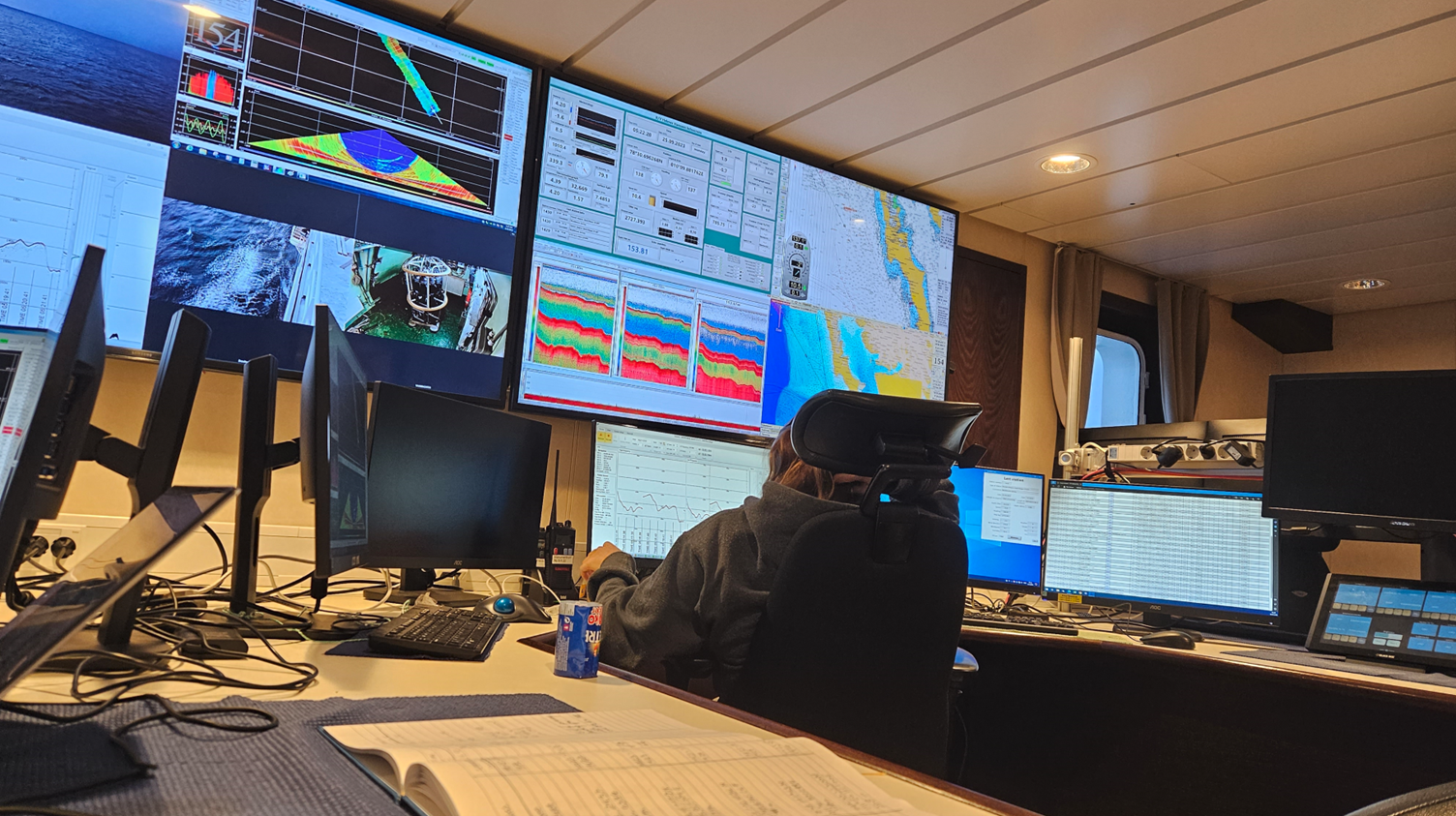
The R/V Helmer Hanssen is equipped with different exchosounders and various seabed and water column sampling devices, such as gravity corer, box corers, vanVeen grabs and CTD probes.
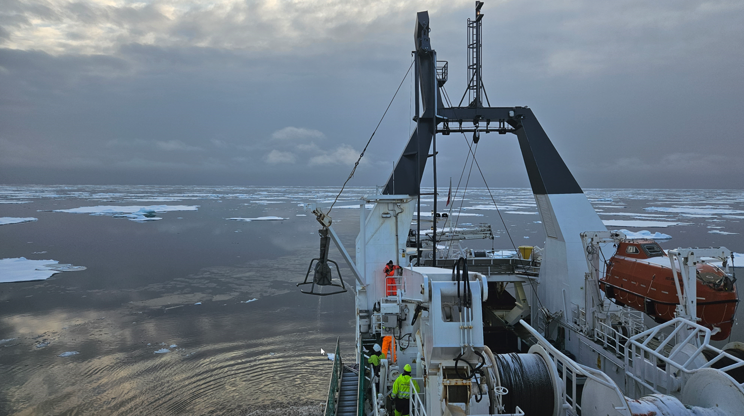
The work aboard the vessel took place in shifts 24/7. The students were manning the instrument room, engaging in the sampling on the deck as well as preparing and analyzing the collected samples in the labs. Seafloor depth and character were recorded using the Kongsberg EM302 multibeam echosounder. Water column was studied with the Simrad EK60 “fishfinder” echosounder and CTD (Conductivity, Temperature, Depth) probe. In addition, EM302 also recorded acoustic water column data. Acoustic sediment structure was acquired using INNOMAR Deep-36 subbottom profiler.
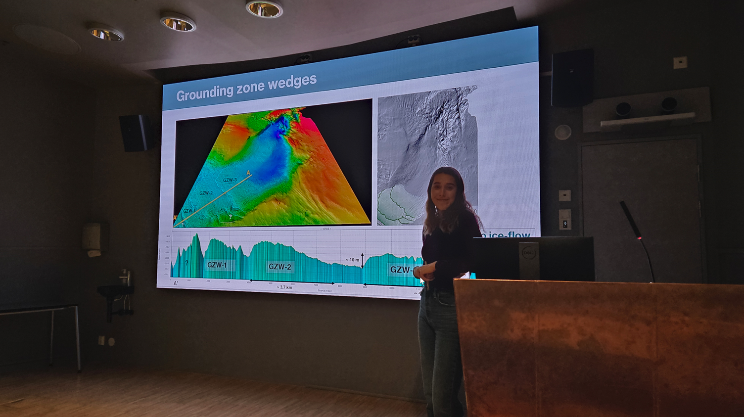
After the cruise, the students continued working with the acquired data in the labs at UNIS. Processing of the swath-bathymetric data was done using the QPS software packages Qimera and Fledermaus. Well-integrated software packages, where each package is designed for completing clearly defined tasks, makes the learning process quick and intuitive. Processing of the depth data into bathymetric grids was achieved with ease in Qimera. These grids were then combined with geological, glaciological and morphological data from various other sources into Fledermaus scenes for geospatial analysis and interpretation. These scenes also served as basis for 3D models and short videos illustrating the final geological, glacial and climate reconstructions. Full work-flow from the acquisition through processing to compiling the final scenes, 3D models and maps was achieved during supervised classroom exercises.
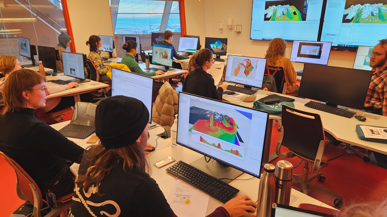
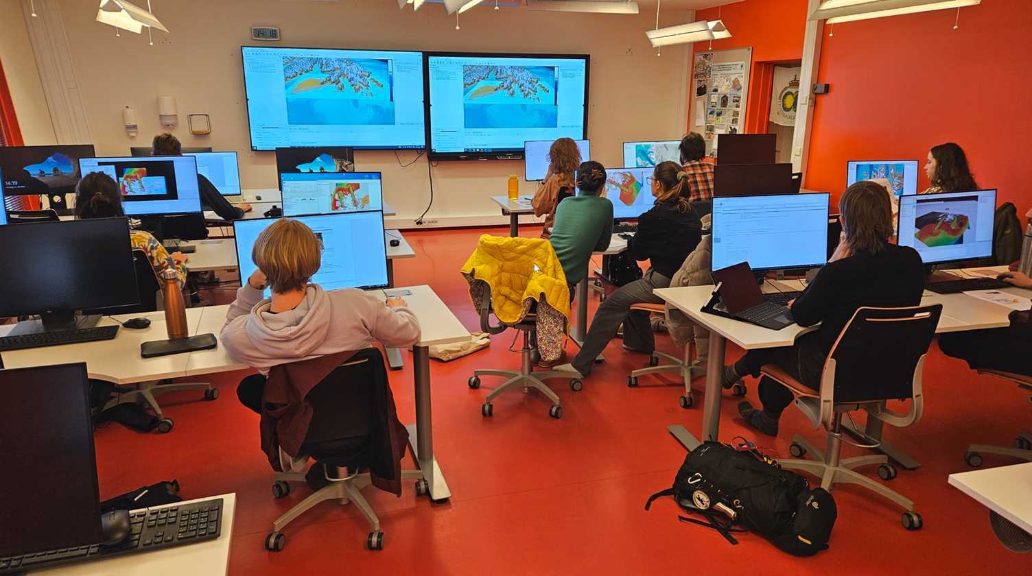
The skills and knowledge acquired during the classroom sessions, the students had a chance to practice while preparing their cruise and lab reports as well as individual term papers. These papers were discussed on seminars throughout the term and the results were presented at the end of the term.