Survey and navigation.
Ping and done.
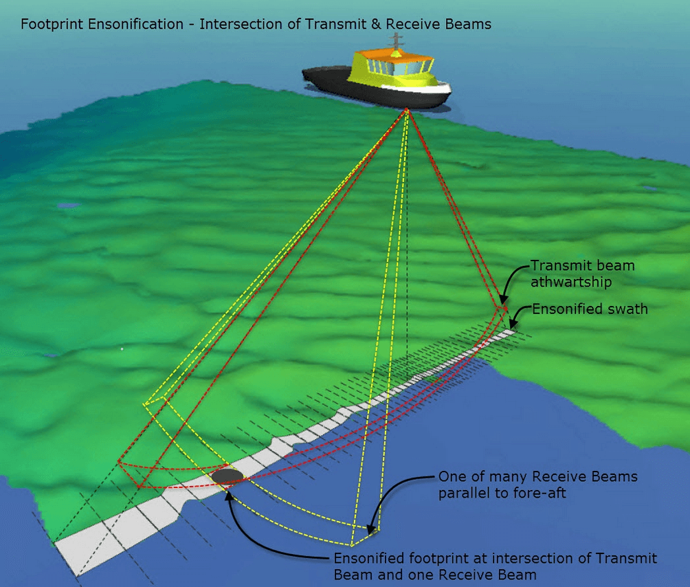
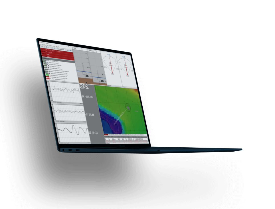
Survey planning, acquisition, and real-time hydrographic data processing with the most stable package on the market.
Contact Sales Free trial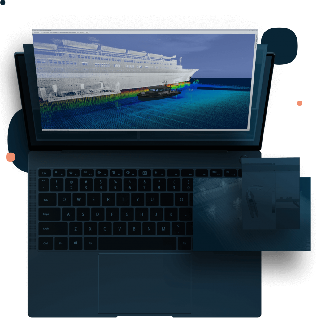
This site uses cookies to create a greater user experience. Read more
Survey planning, acquisition, and real-time hydrographic data processing with the most stable package on the market.
Contact Sales Free trial
Qinsy presents the utmost in reliability, flexibility, and capability.
Qinsy is a survey planning, acquisition, and real-time hydrographic data processing solution, supporting a wide variety of industries, from simple single beam surveys to complex offshore construction works.
Simply put, there is no job that Qinsy can't handle. It has the features and capabilities to meet any client demand. And with stability that is well-known and renowned throughout the industry, clients can feel assured they have a reliable software to ensure even the most difficult jobs through to completion.
Qinsy acquisition is the most reliable in the industry, which leads to improved operational performance for our clients.
Maximize ship time
No more unnecessary and costly ship turns to get back on line.
Scalable
Proven, reliable performance for workflows with multiple sensors and objects.
Embrace the Qinsy philosophy of ensuring good data collection the first time, and "at-the-dock" product delivery.
Online QA/QC
Numerous real-time tools and alerts to ensure accurate data collection.
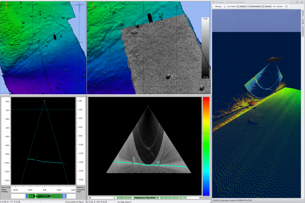
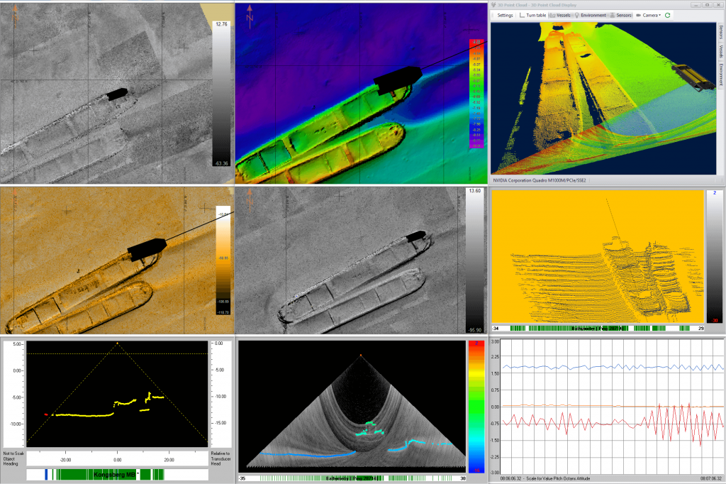
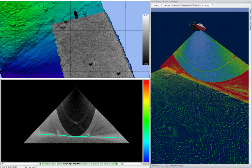
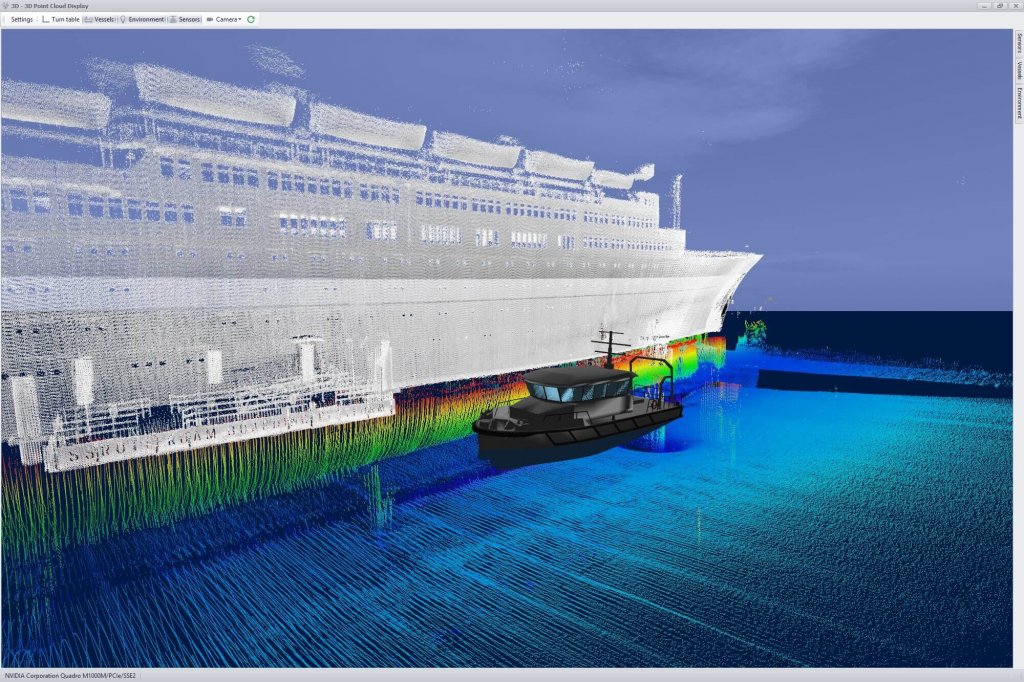
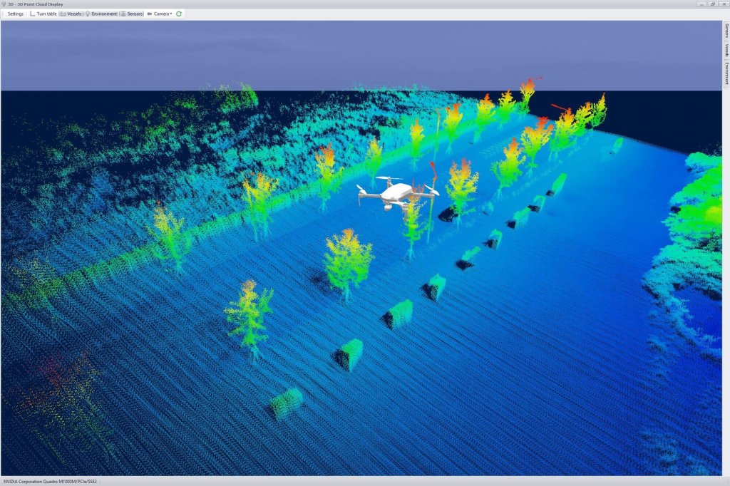
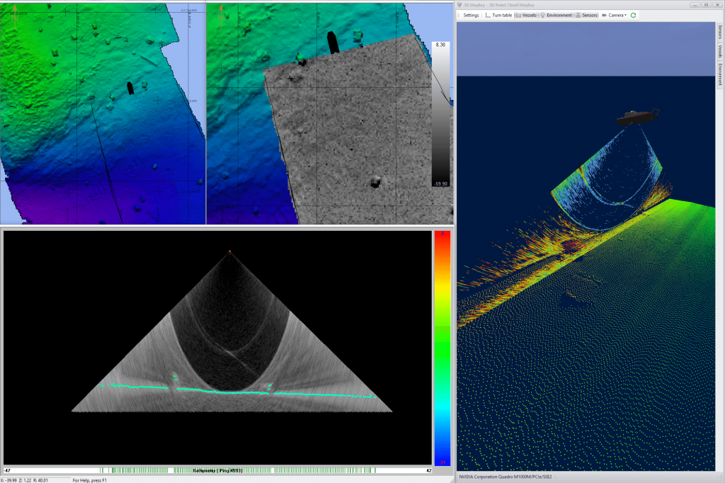
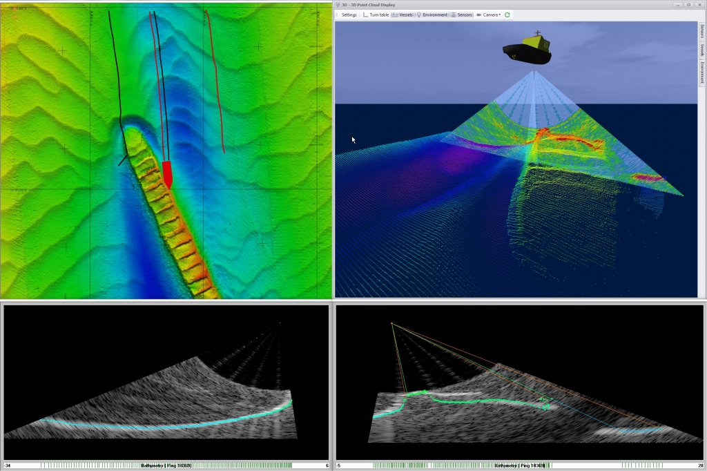
Real-time point clouds and grids
See your final products while you are acquiring them. The benefits are tremendous.
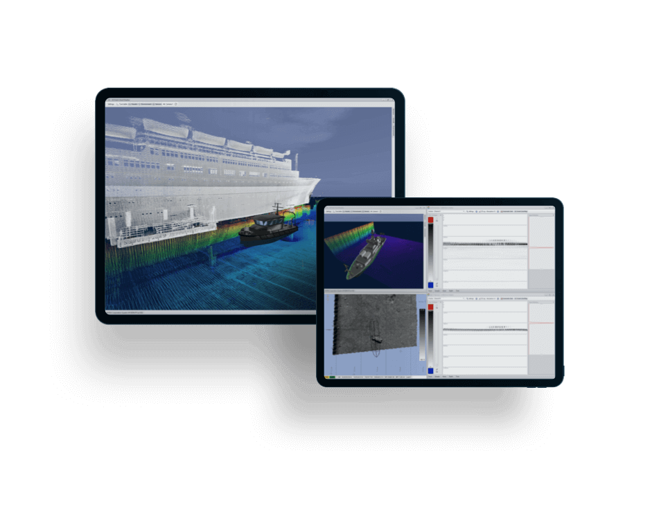
A proven solution for hydrographic and geophysical surveying, marine construction, and numerous other offshore applications.
Surveying
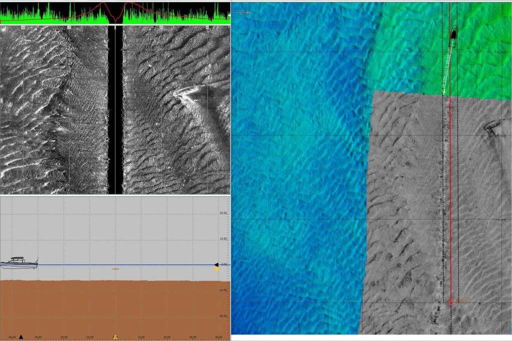
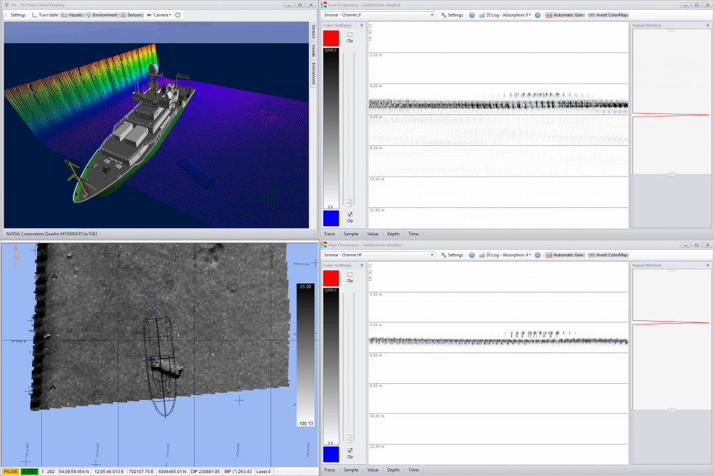
Multibeam, laser, side scan, seismic, sub bottom, and magnetometer support.
Offshore applications
Dredging, cable laying, pipe laying and inspection, with support to rockdumping and rigmoves.
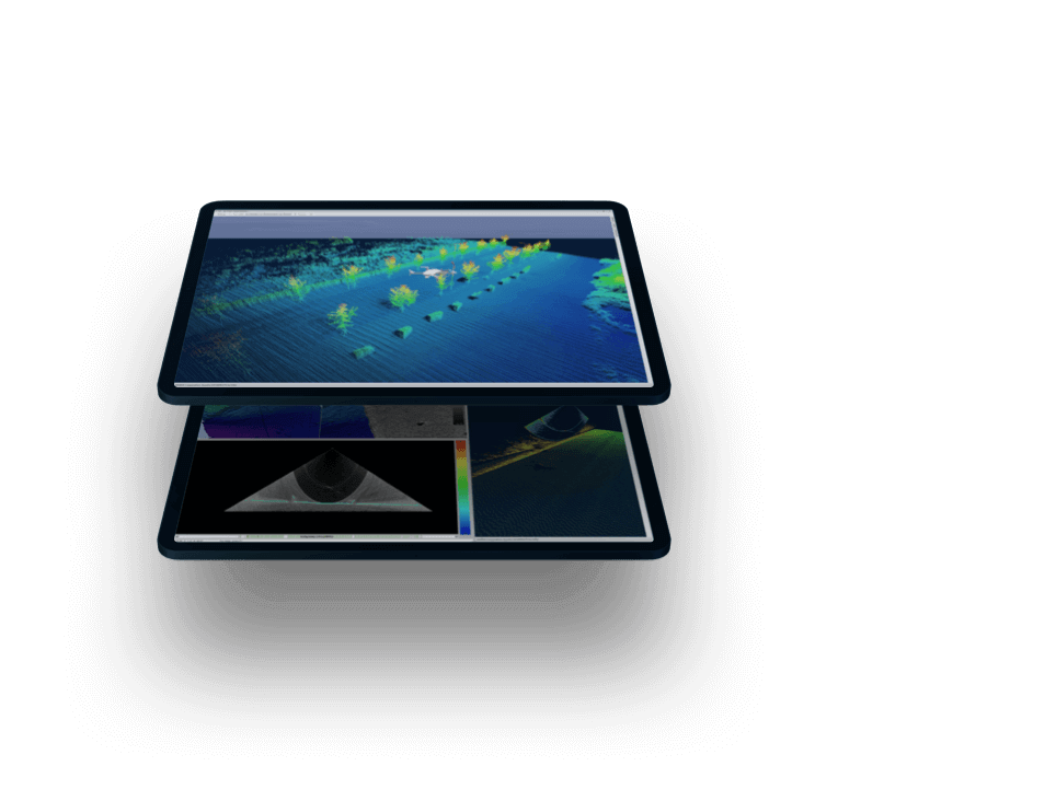
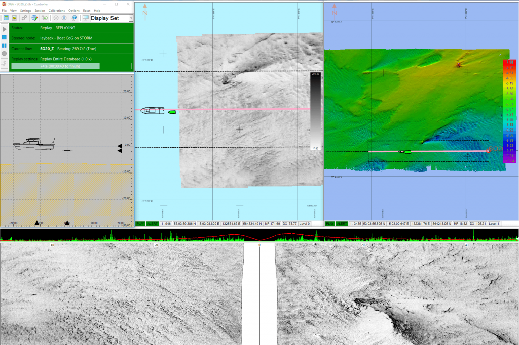
Mission planning, remote display, control, and intelligent auto-line generation.
Autonomous survey mode
Auto-line generation based on processed data from the previous line to ensure no gaps.
Multi-vessel support
Multiple autonomous vessels incorporated into a single project.
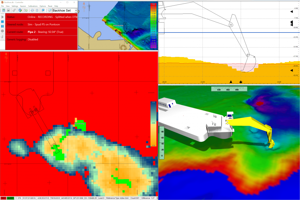
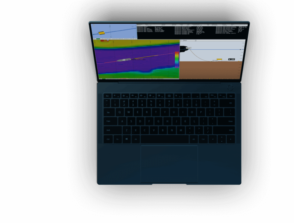
The global leader in dredging and offshore construction applications, with no limit to the degree of complexity in the configuration.
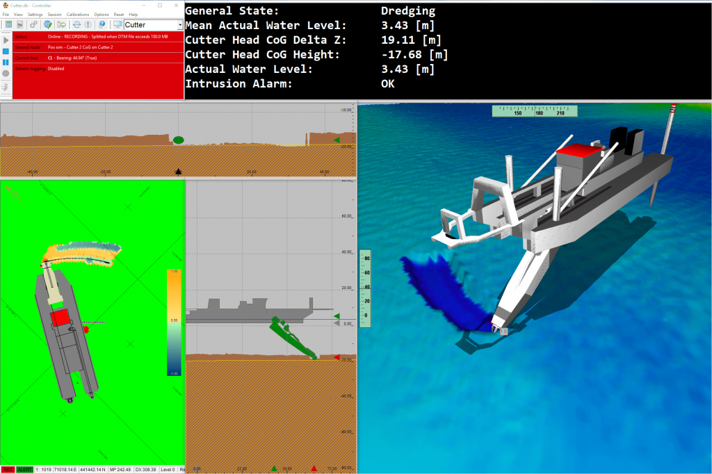
Dredging
Tools for dredge planning, monitoring, model configuration, visualization, safety, and reporting.
Offshore wind farms
Multi-sensor acquisition, object tracking, and cable laying support for offshore installations.
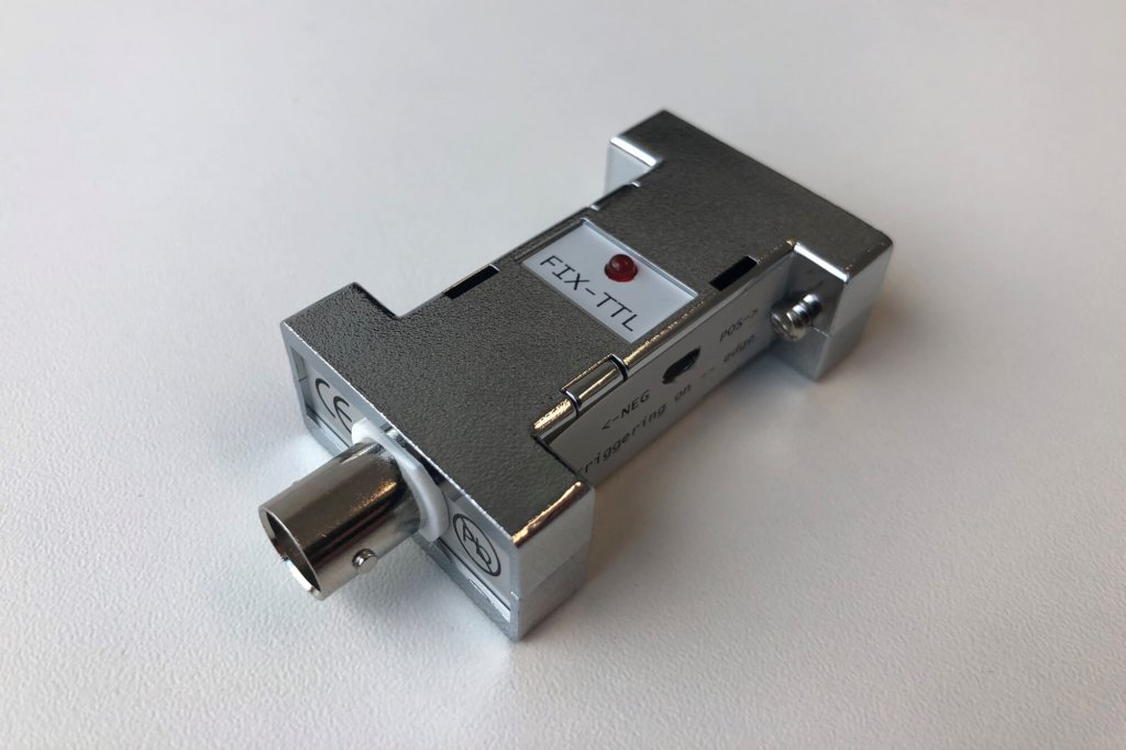
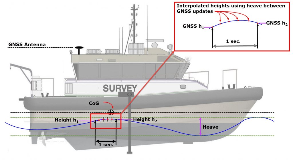
Ensure proper time synchronization with QPS integrated hardware.
PPS Box
Available with the Qinsy software package.


No available add-ons
We're flexible. Licenses available by subscription, as perpetual, or on a rental basis.
What's best for you? Softlock and dongle options are available.
We're ready to assist. Licenses include online and phone support services.
Never get behind. Licenses include access to our latest updates and features.
We innovate. Licenses keeps you on the cutting edge of the industry.
Precise piloting with under-keel clearance and real-time information updates.
Learn more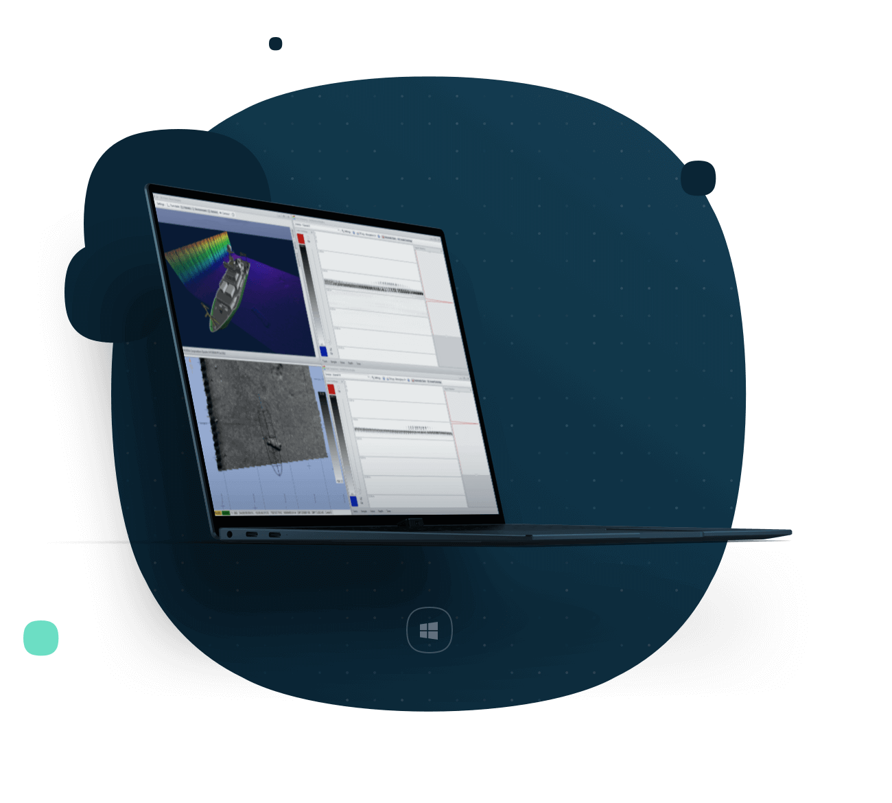
Everything you need to know about Qinsy is below, with regards to specifications, supported platforms, system requirements, and supported file formats.
View all specsMulti-object support
Precisely track the position of multiple defined objects in support of dredging and marine construction applications.
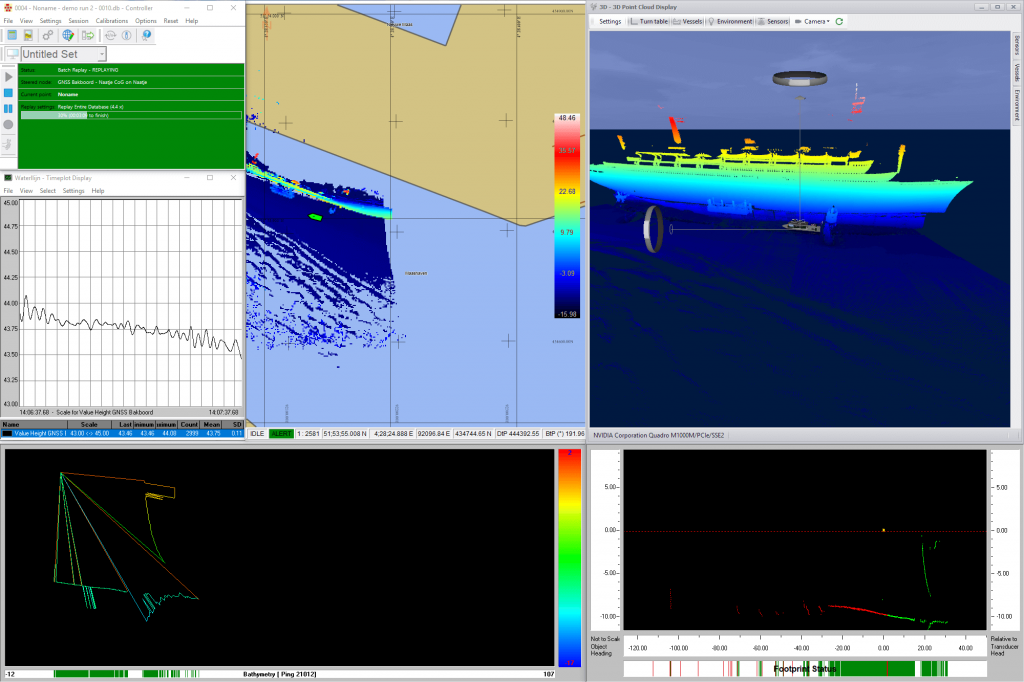
Multi-sensor acquisition
Acquire data from multiple sensors simultaneously.
Sensor type support
Singlebeam, multibeam, laser, side scan sonar, magnetometer, seismic support, and sub bottom profiling.
Positioning and filtering
Multiple inputs (e.g. GPS, INS, tide, USBL, draft, etc.) for real-time positioning in 3D. Can be used in a Kalman filter.
Real-time processing
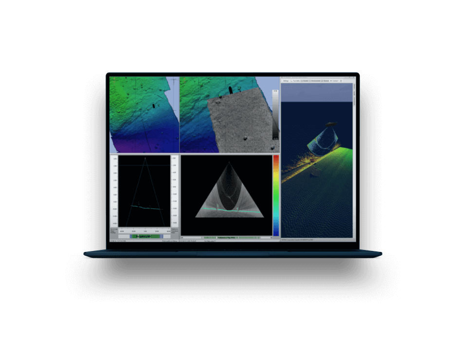
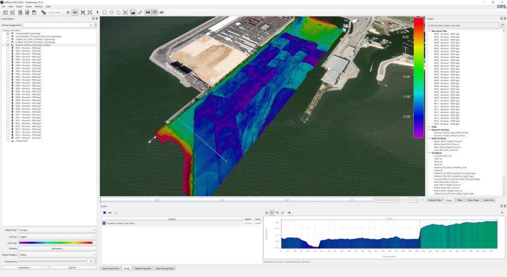
Real-time processing of point clouds, bathymetric grids, and side scan sonar mosaics for optimal qa/qc and rapid "at-the-dock" product delivery.
Real-time displays
Navigation display (layers: ENC, DXF/DWG, Geotiff ECW) multibeam displays, Numerics, profile display, and 3D displays.
Autonomous support
Autonomous vessel support with mission planning, intelligent auto-line generation, and remote display and control.
Dredging support
Setup applications, object configuration, monitoring, visualization, safety precautions, and reporting tools for dredging.
Want to give our software a spin? See what it’s like in real life or just test its capabilities. Try it out today!
Get free trial