Webinar: The Essentials of a Bathymetric Survey
Watch the webinar below, and enjoy the walkthrough of a typical hydrographic survey.
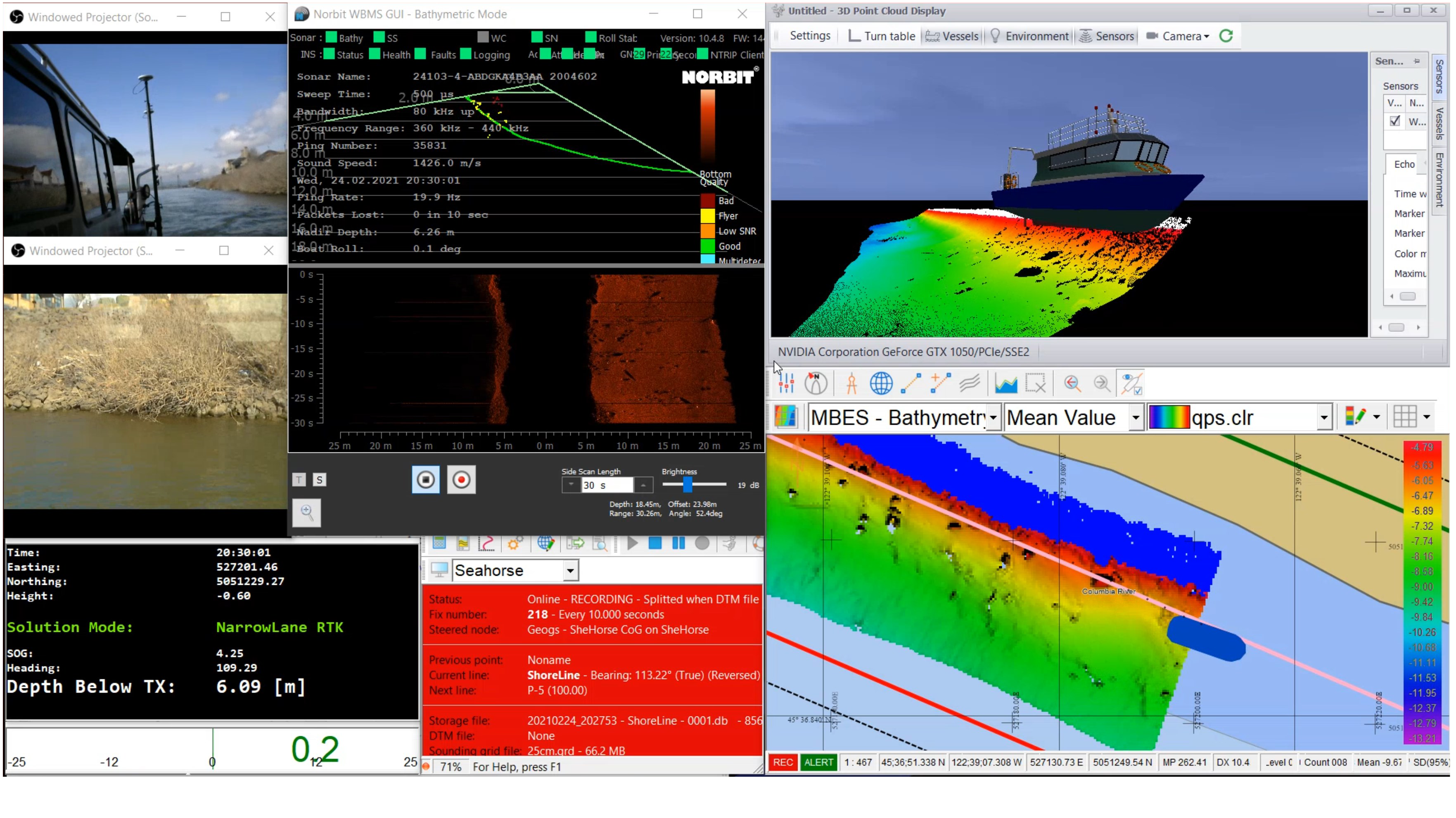
Seahorse Geomatics will detail the operational requirements of mobilizing a vessel and acquiring quality hydrographic data with a high resolution multibeam. Using QPS’s Qinsy navigation suite, watch a vessel perform real-time QA/QC of bathymetric data while seamlessly processing the data using Qimera’s tools. With this workflow, any size survey can be a quick Field to Finish turn around.