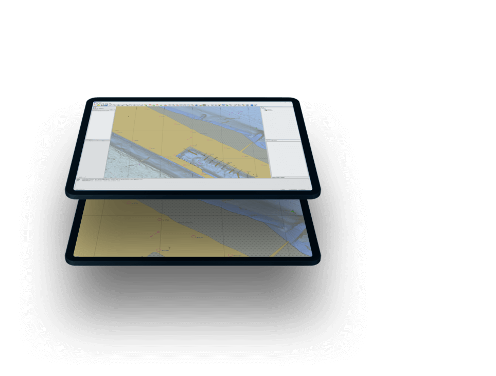
Bathymetric ENC production.
Maximise navigable waters.
Rapid, automated ENC production from high resolution source bathymetry. The tool of choice to enhance port operations.
Contact Sales Free trial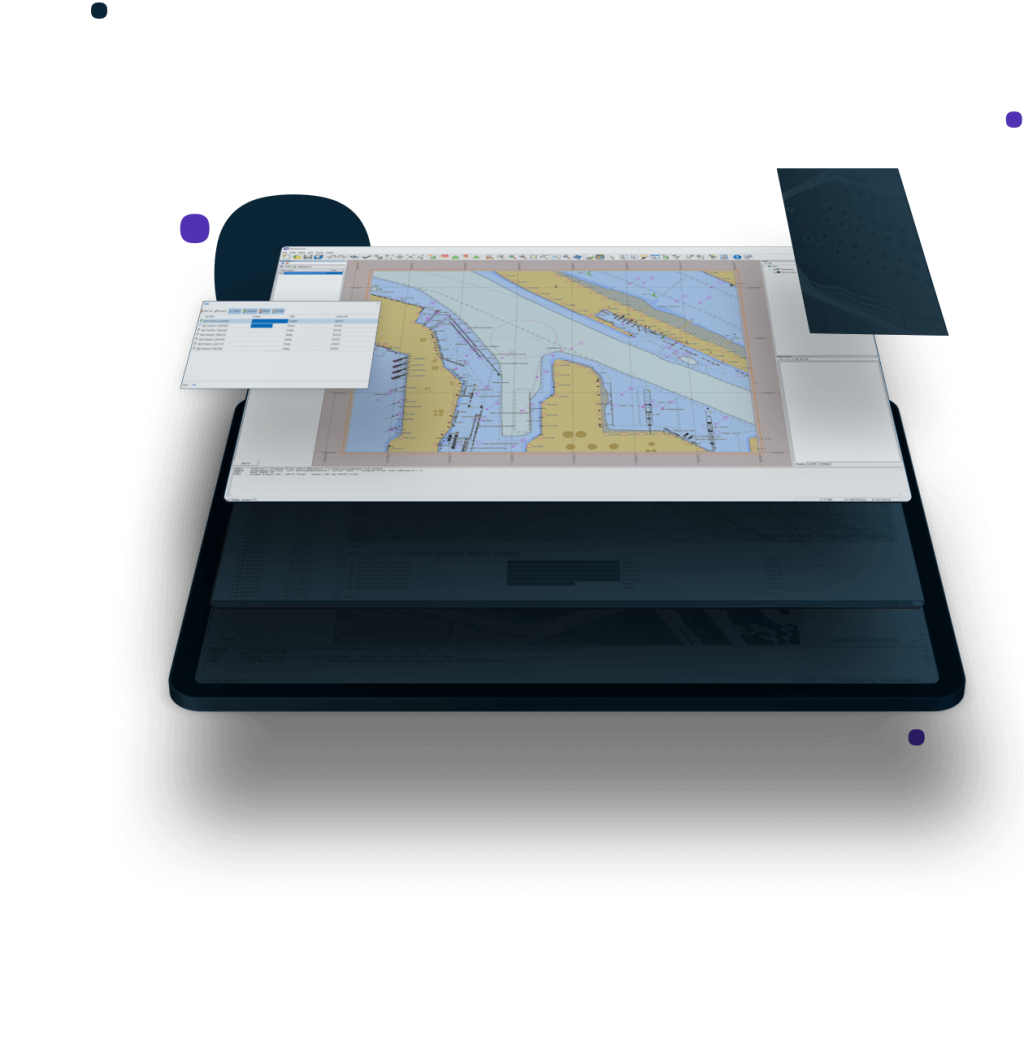
This site uses cookies to create a greater user experience. Read more
Rapid, automated ENC production from high resolution source bathymetry. The tool of choice to enhance port operations.
Contact Sales Free trial
Qarto presents the utmost in simple, rapid, data-robust product production.
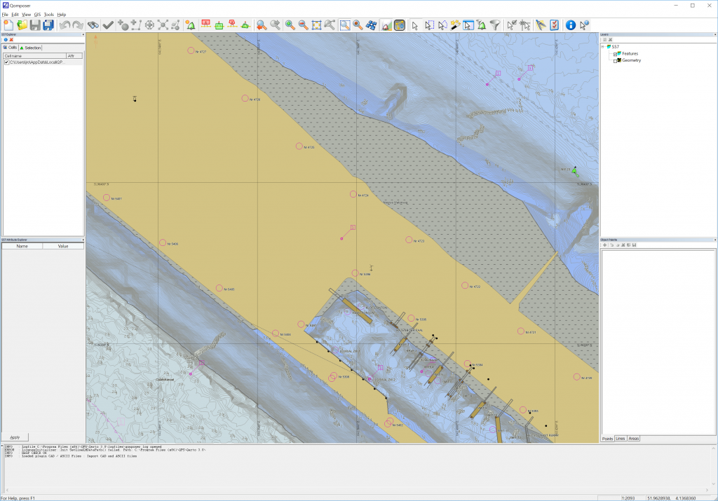
Qarto is ENC production software. Built for rapid and automated product turnaround, Qarto is the tool of choice for some of the largest ports in the world, ensuring timely products and safe operation on those busy waterways within them.
The strength of Qarto is very fast and automated ENC production. Qarto makes possible the short turn-around times from survey to chart that are necessary for the safe operation of busy waterways, e.g. in the Westerschelde and the Port of Rotterdam.


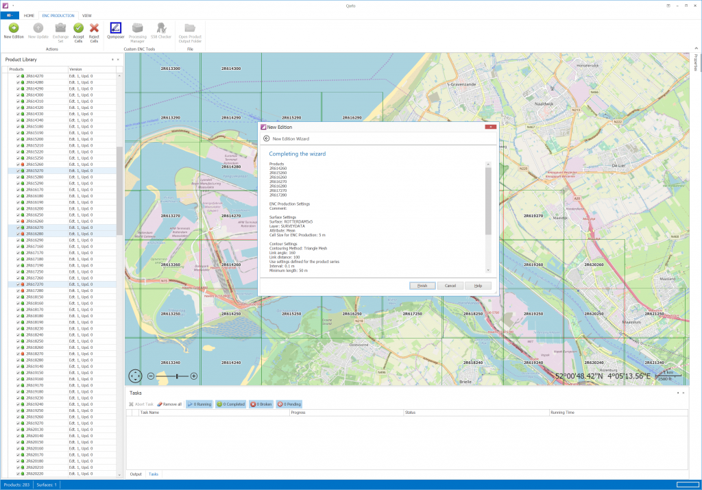
Workflows are streamlined and guided to ensure ease of use and eliminate error, for junior and senior personnel alike.
Wizards
Allow for easy configuration of jobs in queue.
Guided workflows
Users are suggested of the next logical course of action.
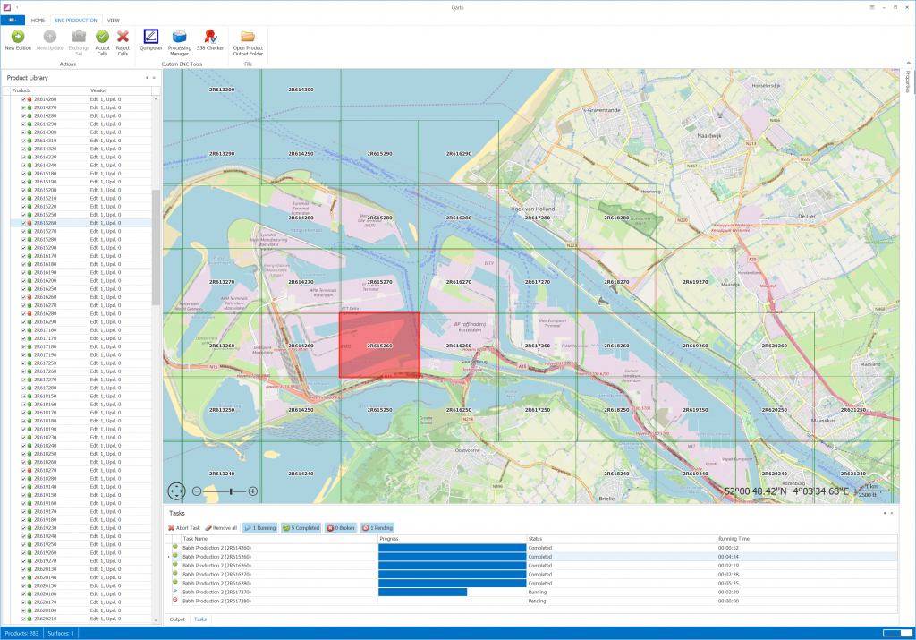
The core strength of Qarto is in the speed that ENC products are generated, an important part of the rapid survey-to-product turnaround.
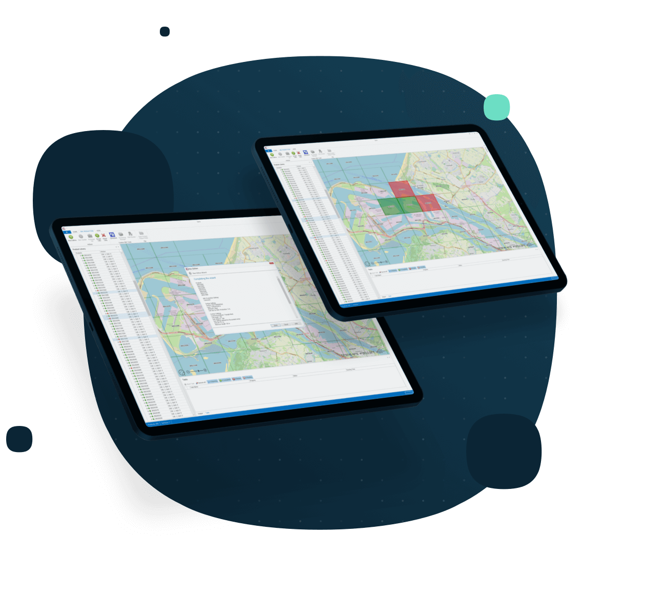
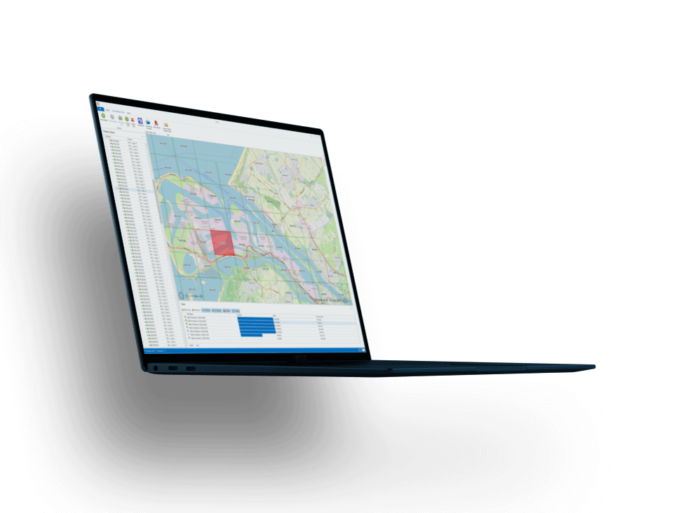
Batch processes
Bulk ENC product production, combining ENC base cells with daily, verified hydrographic survey results.
Unprecedented turnaround
Proven system in major ports to distribute new ENCs with updated survey results within 1-3 days.
Qarto workflows embrace current standards, displays, and integrates with other commonly used production suites.
Standards compatibility
Edit and create S-57, meet inland ECDIS standards, and present objects per S-52 standards.
Database Integration
Open interfacing with existing databases, including ESRI as part of an ENC Production suite built on ArcGIS.
Capable of high-resolution product generation, while still maintaining the speed in production.
High-density ENCs
ENCs with 10 cm contour intervals maintains critical information from newly updated bathymetry.
Benefit to ports
High-resolution bathymetry reveals expanded safe water, facilitates ship movement, and enhances port operations.
No available add-ons
We're flexible. Licenses available by subscription, as perpetual, or on a rental basis.
We currently offer HASP dongles for Qarto license activation.
We're ready to assist. Licenses include online and phone support services.
Never get behind. Licenses include access to our latest updates and features.
We innovate. Licenses keeps you on the cutting edge of the industry.
Precise piloting with under-keel clearance and real-time information updates.
Learn more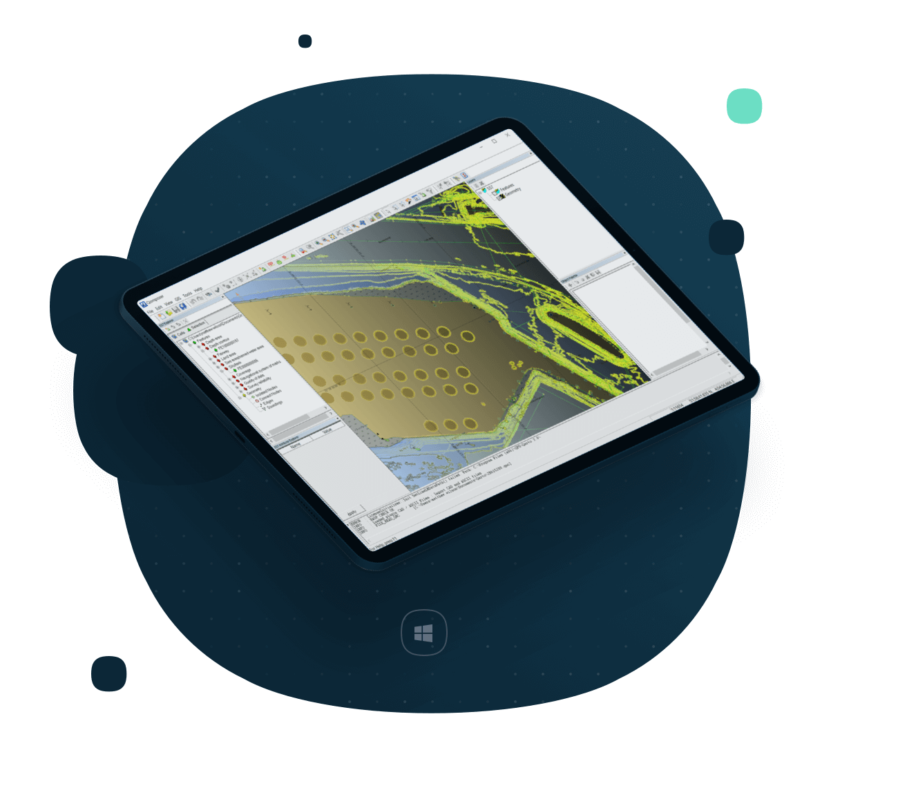
Everything you need to know about Qarto is below, with regards to specifications, supported platforms, system requirements, and supported file formats.
All specifications.ENC Production
Fast and automated port solutions for ENC production.
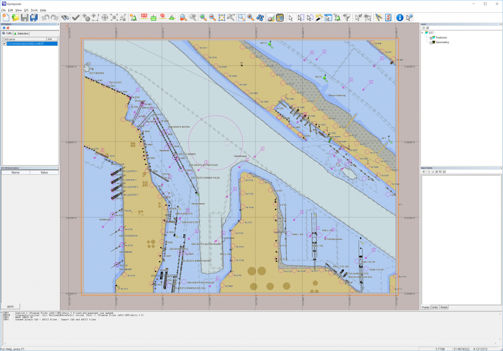
S-57 Editing
Bundled with Qomposer for S-57 editing of features, feature geometry, and feature validation.
High-resolution ENC product creation
ENC production with high-density bathymetric components (e.g. 10 cm contour intervals) as an accepted and proven part of the workflow.
ESRI integration
Directly integrated with ESRI as part of an ENC Production suite built on ArcGIS.
Standalone operation
Generate ENC products directly from ENC base cells and updated bathymetry.
Source file compatibility
Import source files (e.g. CAD, imagery, S-57) to be used as inputs to new ENC generation.
Want to give our software a spin? See what it’s like in real life or just test its capabilities. Try it out today!
Get free trial